Although the present Rhône is divided into two main arms, the positions of its channels and mouths have varied throughout the Holocene (Russell, 1942; Kruit, 1955; Oomkens, 1970; L’Homer et al., 1981; Arnaud-Fassetta, 1998; Vella and Provansal, 2000; Vella et al., 2005). Shoreline progradation at this time scale was controlled by river-mouth position and sediment supply.
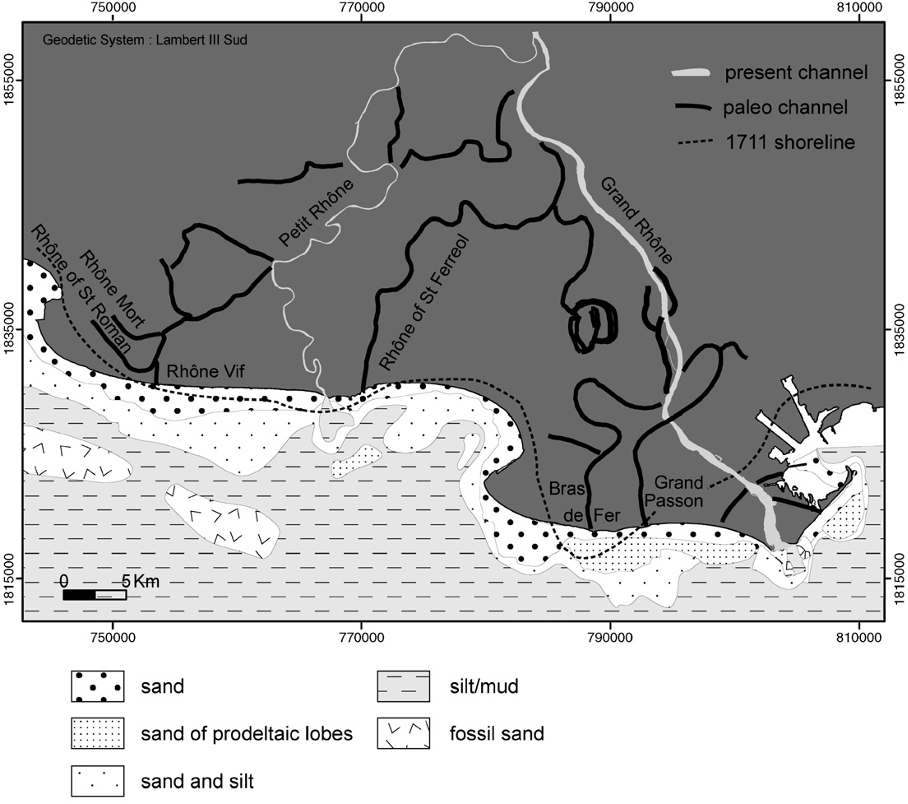
Since 4000 yr BP, the Rhône has developed multiple successive mouths, leaving relict structures in the deltaic plain. Vella et al. (2005) revised the chronology of these subsurface sedimentary ridges, highlighting offshore abandonment of prodeltaic lobes such as St Ferreol (ca. 2845–2420 BC–1st century AD), Grand Passon–Bras de Fer (12th century–1711), and Pégoulier (1711–1892). These lobes are still identifiable in bathymetry and granulometry, e.g., at the Roustan and Orgon mouths (Fig. 1). The existence of a Rhône Vif lobe (1532–1552) remains uncertain, as its low-discharge artificial mouth was likely too short-lived to form a significant lobe.
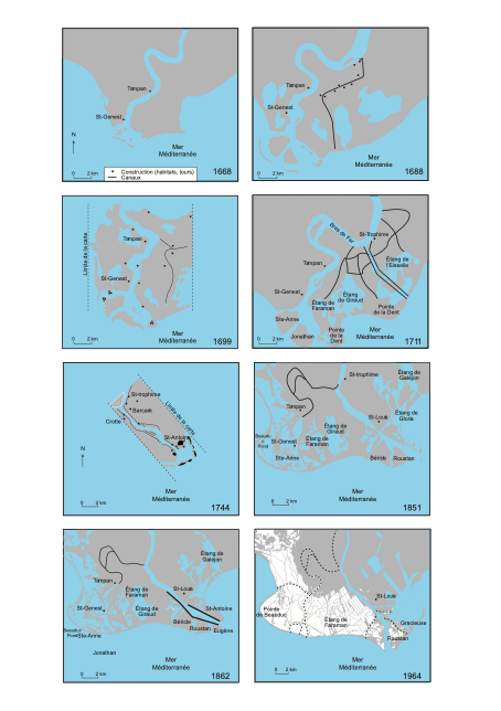
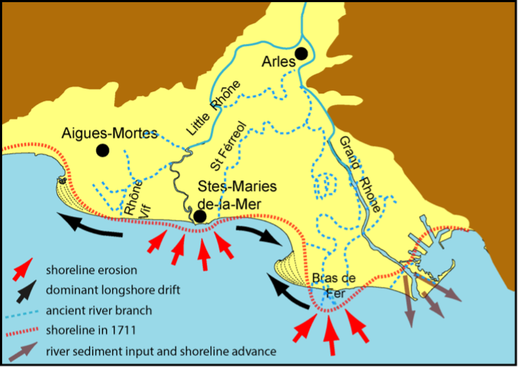
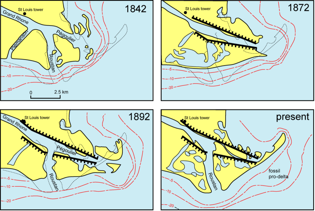
Since 1552, the Petit Rhône (Orgon) mouth has remained fixed west of Saintes-Maries-de-la-Mer (Fig 1). The modern shoreline began forming in the early 18th century; after a major flood in 1711, the Bras de Fer channel shifted east, creating the present Grand Rhône (Fig. 2-3). Between 1711 and 1852, three mouths were active: Piémanson, Roustan, and Pégoulier. Engineering works closed Piémanson and Roustan in 1855 to concentrate flow toward Pégoulier, which later filled as Roustan reopened for navigation in 1892. Since then, the Grand Rhône has discharged primarily through Roustan, with longshore sediment transport contributing to the closure of Pégoulier (Fig. 4).